Machame route, as well known as the Whisky Route is one of the most scenics and recommended routes on Kilimanjaro. This popular route with paths through magnificent forests to gain a ridge leading through the moorland zones to the Shira Plateau. It then traverses beneath the glaciated precipices of the Southern Ice fields to join the Barafu Route to the summit. Because it can be done over longer periods and the incline is more manageable it has a much higher success rate of the summit.
- Machame Gate to Machame Camp
- Elevation (ft): 5,400ft to 9,400ft
- Distance: 11 km
- Hiking Time: 5-7 hours
- Habitat: Rain Forest
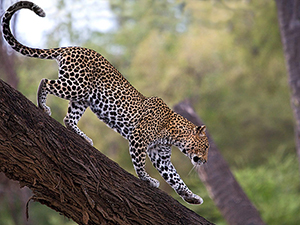
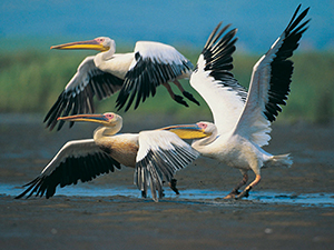
Drive from Arusha to Mt Kilimanjaro National Park, passing by the village of Machame to meet your climb crew at the Machame Gate. As you begin the gentle ascent, the trail winds through the verdant Afromontane rainforest that beards Kilimanjaro’s lower slopes. Moss and tattered lichen dangles from tall branches, tree ferns rest in soft cradles, and begonias, busy Lizzie impatiens, and violas bloom year-round in multiple colors on the forest floor. Many species of birds – as well as colobus monkeys, blue monkeys, and other creatures of the forest – can be seen and heard. The first camp is set amongst giant heather at Machame Camp
- Machame Camp to Shira Camp
- Elevation (ft): 9,400ft to 12,500ft
- Distance: 5 km
- Hiking Time: 4-6 hours
- Habitat: Moorland
After Breakfast Leave the glades of the rainforest behind, you continue on an ascending path along a steep ridge onto heather-clad moorland. This is known as the heath zone and, as the vegetation becomes more sparse, attractive helichrysum and lobelia are the only plants dominating the harsh mountain landscape. Various geological features can be observed, ranging from lava tubes to glacial valleys. A picnic lunch is taken on trail today. Continue up a rocky ridge onto the Shira Plateau. By now you can see the Western Breach with its stunning glaciers, and after a short hike you reach the Shira Camp. Your tent tonight can definitely be described as “a room with a view” looking out towards the snow-dusted Kibo peaks. Overnight Shira Camp.
- Shira Camp to Lava Tower to Barranco Camp
- Elevation (ft): 12,500ft to 13,000ft
- Distance: 10 km
- Hiking Time: 6-8 hours
- Habitat: Semi Desert
Today is a walk-high sleep-low day. You ascend into the alpine desert towards the main peak of Kibo, where the western glaciers become clearly visible. Lunch is taken as a picnic en route. If you feel very strong there is an optional ascent of the 300-foot-tall Lava Tower before descending to Barranco Camp in the afternoon, passing through the strange yet beautiful ‘Garden of the Senecios’ (giant groundsel), which also features many giant lobelias. The Barranco Valley is one of the prettiest areas of the entire trail. Hut at an altitude of 13,000ft. Here we rest, enjoy dinner, and overnight. Although you end the day at the same elevation as when you started, this day is very important for acclimatization and will help your body prepare for the summit day
- Barranco Camp to Karanga Camp
- Elevation (ft): 13,000ft to 13,100ft
- Distance: 5 km
- Hiking Time: 4-5 hours
- Habitat: Alpine Desert
After breakfast, we leave Barranco and continue on a steep ridge passing the Barranco Wall, to the Karanga Valley campsite. This is a short day meant for acclimatization.
- Karanga Camp to Barafu Camp
- Elevation (ft): 13,100ft to 15,300ft
- Distance: 4 km
- Hiking Time: 4-5 hours
- Habitat: Alpine Desert
After breakfast, we leave Karanga and hit the junction which connects with the Mweka Trail. We continue up to the Barafu Hut. At this point, you have completed the South Circuit, which offers views of the summit from many different angles. Here we make camp, rest, enjoy dinner, and prepare for the summit day. The two peaks of Mawenzi and Kibo are to be seen from this position.
- Barafu Camp to Summit to Mweka Hut
- Elevation (ft): 15,300ft to 19,345ft (and down to 10,000ft)
- Distance: 5 km ascent / 12 km descent
- Hiking Time: 7-8 hours ascent / 4-6 hours descent
- Habitat: Arctic
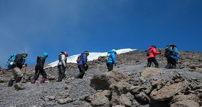
Very early in the morning (midnight to 2 am), we continue our way to the summit between the Rebmann and Ratzel glaciers. You head in a northwesterly direction and ascend through heavy scree towards Stella Point on the crater rim. This is the most mentally and physically challenging portion of the trek.
At Stella Point (18,600 ft), you will stop for a short rest and will be rewarded with the most magnificent sunrise you are ever likely to see (weather permitting). From Stella Point, you may encounter snow all the way on your 1-hour ascent to the summit. At Uhuru Peak, you have reached the highest point on Mount Kilimanjaro and the continent of Africa. Faster hikers will see the sunrise from the summit.
From the summit, we now make our descent continuing straight down to the Mweka Hut camp site, stopping at Barafu for lunch. You will want gaiters and trekking poles for the loose gravel going down. Mweka Camp is situated in the upper forest and mist or rain can be expected in the late afternoon. Later in the evening, we enjoyed our last dinner on the mountain and a well-earned sleep.
- Mweka Camp to Moshi
- Elevation (ft): 10,000ft to 5,400ft
- Distance: 10 km
- Hiking Time: 3-4 hours
- Habitat: Rain Forest
After breakfast, we continue the descent down to the Mweka Park Gate to receive your summit certificates. At lower elevations, it can be wet and muddy. Gaiters and trekking poles will help. Shorts and t-shirts will probably be plenty to wear (keep rain gear and warmer clothing handy).
From the gate, you continue another hour to Mweka Village. A vehicle will meet you at Mweka village to drive you back to the hotel in Moshi./ Arusha .
COST INCLUDES
- Transport to & from the mountain ex Nairobi (Shuttle Bus)
- Accommodation at Arusha Center Inn Hotel BB
- Porters, Guide & Cooks Fee
- Three meals a day whilst on the mountain
- All hut & camping fees
- All park entry fees
- Certificate of achievement
NOT INCLUDED
- Tipping to the guide – 15usd per day porters – USD $ 7 per day, cooks –USD $1 0 per day
- Personal climbing gear – clothing’s & rucksack
- Personal travel insurance
- Beverages & mineral water
- Items of personal nature.
- Visa – USD $ 50 – 100 depending on nationality.
- A Rack sack For Your Equipments – To Be Carried By Porters
- Sleeping Bag [Mountain Type],
- Hiking, or Climbing Boots, Camp Shoes, Trainers Not Sandals
- Socks. 2 Thin Polypro Type For Quick Drying, 4 Thick Wind Pants, Wind shirts
- High Gaiters, Warm Pants [Fleece], Jacket Or Pullover, 1 Rain Parka
- 2 Underwears,1 Hiking Shirt, Long Sleeve, 1 Bandanna
- 1 Warm Hat, 1 Hiking Shorts, Pants, Balaclava, Fleece Neck Warmer
- Headlamp, Bulb, Batteries, First Aid Kit, Pocketknife, Sunglasses, Snow
- Goggles, Water Purification Tablets
- Toiletry Item, Plus Sunblock, Lipsalve, And Moisturizer
- Walking Stick